
The 3D scanning app for surveyors & civil engineers
Add instant 3D mapping to your professional surveying toolset. Accurately document as-builts, plot plans, footprints, site surveys, utilities, infrastructure, and more - right from your LiDAR-enabled phone or tablet.Start testing today with our new 10-step guide:Trusted by leading organizations:


Firsthand accounts from the field
-
![]()
“Today I had the chance to try out Dot3D and it was amazing. It's hard to understand the benefits of a tool like this until you actually try it out in the field. What would have taken about a day and a half can now be completed in half a day...”
-
![@O_Hitsuji_san]()
"What I like about Dot3D is that it has a fast processing time, yet still produces high enough accuracy that it's very useful."
-
![]()
"Dot3D is very effective when surveying current conditions like this. Surveys can be completed in less time than with a terrestrial laser scanner. Also, the density of the points is high, making it easy to understand the location."
-
![imvisionlabs]()
"I used PotreeDesktop to visualize point cloud data acquired on an iPhone LiDAR. The colors look beautiful and the zoom in/out is very smooth and convenient! I used the iPhone LiDAR app Dot3D."
-
![]()
"Today we are inspecting a newly constructed building that stretches over 50m horizontally. We spent 10 minutes scattering 10 Apriltags while taking photos of the buildings, then 15 minutes observing the Apriltags with drogger RTK, and finally 10 minutes scanning with Dot3D. After returning to the office, it took about five minutes to import the CSV and optimize it. We were able to output point cloud data that allowed us to accurately measure the building's dimensions."
-
![]()
“Point clouds with high density and high contrast are easier to trace. The point cloud density of DOT3D is too high, so it can be used in practice even if it is thinned to about 10%.”
-
![]()
“The image shows a residential lot in Tokyo. Dot3D measurement range: 150 to 250 m2. When I converted it to LAS, the data size was about 250MB. If 2GB is possible, it seems like it would be possible to process almost an entire residential site in Tokyo. If we can classify them to this extent, it seems that the amount of work required for drawing in 3D → and 2D can be significantly reduced.”


A game-changer for surveyors

Unparalleled loop closure
Highly accurate results on every scan via…
Proprietary optimization and loop closure algorithms
Compatibility with unique coded targets (AprilTags)
Advanced survey control targeting workflows
Semi-automatic referencing of known measurements
Enhanced by GNSS/RTK
Reference geospatial coordinates via…
Access to real-time GPS/GNSS signals from your phone/tablet
Compatibility with high-accuracy GNSS/RTK (DA2, FLX100)
Survey targeting workflows with GNSS receivers, total stations
Direct access to global coordinate systems on export

Ultra fast, secure results
Maximize efficiency on the job site via…
Truly instant data capture with real-time feedback and results
Rapid local processing with no cloud or internet requirements
Proprietary point cloud compression in the native .DP format
Multi-platform solution with iOS, Windows, and Android apps

Highly affordable technology
Avoid hefty initial investments! Start today with…
FREE trials available with unlimited capabilities for the first 7 days
Professional scanning plans starting at only $349.99 / year
Compatibility with low-cost scanning hardware (iOS LiDAR, RealSense)
Direct export to highly compatible formats for use in existing workflows
Ready? Let’s go.
Featured Projects
iPhone 13 Pro LiDAR Mapping - Tokyo Digital Twin Award
“An amazing capture of a river park taken by iPhone 13 Pro. The attached video is a recording of the winning work of the “Tokyo Digital Twin Award". This was captured by one person using affordable hardware such as iPhone13 Pro, Drogger RWP (GNSS antenna), DJI OM 5 (gimbal), and applications such as Dot3D Pro for iOS (LiDAR capture) and ALES (RTK service).
This work is available to see on Tokyo Digital Twin platform. The “Tokyo Digital Twin Project 3D Archiving Event” was held from December 2022 to January 2023 by the Tokyo Metropolitan Government, as a part of the ”2nd Mincap Award”, a 3D city space capture event using LiDAR or photogrammetry sponsored by both public and private sectors. Tokyo seems to see this event as a test of extensive data collection by the private citizen using inexpensive equipment.
- Ryotaro Kato, GPR Survey Engineer on LinkedIn

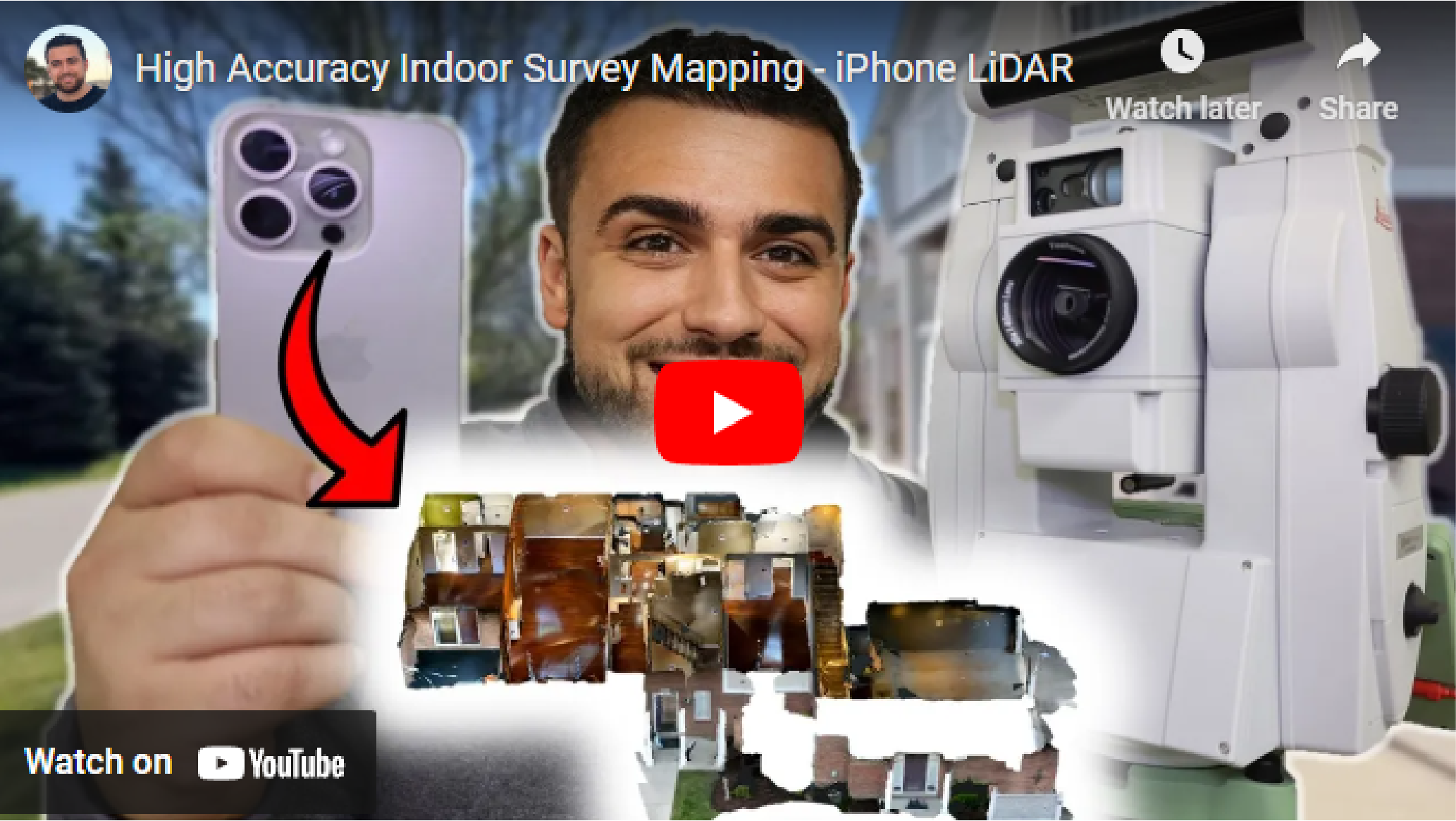
Indoor Survey Mapping with iPhone 15 Pro and Dot3D
“Today, we embarked on an exciting journey of indoor survey mapping using our iPhone 15 Pro.
Our mission? To map the inside of a condo with survey-grade accuracy, projecting everything into State Plane coordinates, and create a point cloud that we can integrate into other spatial data like a drone point cloud.
To ensure accuracy, we set up numerous April targets around the condo. Not only did these targets help us tie our scans together, but we also used a Total Station to survey all these targets, carrying our geodetic coordinates indoors.”
-Rami Tamimi, professional surveyor and geodetic engineer on YouTube
-
Get started today with just an iPhone Pro (12 & up) or iPad Pro (2020 & up) with built-in LiDAR. If you prefer to start with a Windows or Android device, you’ll need an Intel RealSense or DPI external camera. The software trial is free on all platforms.
-
Pro is our most popular option for most iPhone/iPad users relying solely on their embedded LiDAR camera (iOS). Prime is a premium solution for leveraging external 3D cameras on Windows/Android or external GNSS receivers (i.e. Trimble DA2) on iOS.
-
YES! The use of coded targets (AprilTags) is one of the most important capabilities of Dot3D. Please click here to download Dot3D AprilTags for printing, and see here for several tutorials on their use. You also have the option to order a rugged set here.
-
Don’t worry! No automatic charges will occur. Once your trial ends, you’ll automatically revert back to FREE mode, still allowing scanning and testing, but with some limited functionality and NO EXPORTS. You may then upgrade to PRO or PRIME anytime.
Let’s connect
Register below for instant access to our free guide to getting started with Dot3D for Surveying: